
MENU
Satellite Remote Sensing
Satellite remote sensing (RS) has been a tool employed extensively in the terrestrial and marine environments since the 1970's. Dr. Bill's research utilizes RS to look at nearshore temperate marine environments where giant kelp (Macrocystis pyrifera) is found. Hard to imagine, but you can detect the kelp surface canopy, and occasionally its subsurface presence, from these satellites orbiting 400+ miles above earth's surface.
Due to its higher spatial resolution (20-meters), the French SPOT satellite has been used by Dr. Bill Bushing and his co-researcher Dr. Thomas Belsher of the French oceanographic institution IFREMER in Brest, France.
The reason is that kelp is highly reflective in the near infrared (NIR) wavelengths of light while the ocean is strongly absorptive of these wavelengths. The result is a very dark black background where clear water exists, and a brighter signal in areas where kelp canopy is extensive. Note the following images of giant kelp beds around the coast of Santa Catalina Island near Little Harbor:
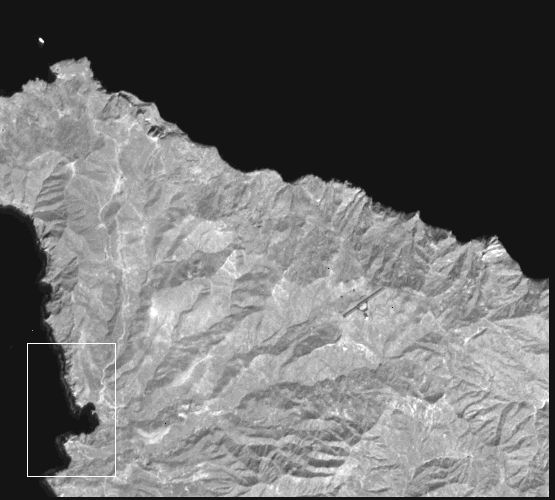
SPOT Satellite Image of Catalina in NIR March 15, 1990.
Area near Little Harbor indicated by white rectangle.
© 1999 Drs. Bill Bushing and Thomas Belsher
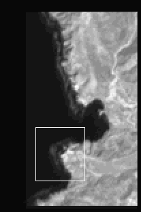
Enlargement of above image in
the vicinity of Little
Harbor.
Indian Head Point area
outlined in white rectangle.
© 1999 Drs. Bill Bushing and Thomas Belsher
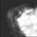
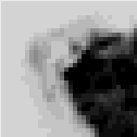
Varying density of kelp canopy indicated
in the area of
Indian Head Point
(positive and negative images)
© 1999 Drs. Bill Bushing and Thomas
Belsher
| Home Page | Products and Services | Scientific Research | About Us | Contact Us |
This document maintained by
Dr. Bill Bushing.
Material
Copyright © 2000 Star Thrower Educational Multimedia